Tuesday, March 13, 2012

WhaleWatch Score

Here is how it will go for the next couple of months. I will drive out along Lake Crescent. There will be weather of some sort or other, and beauty of some sort or other.

Lake Crescent, March 10, 2012 (Click for larger image.)

This time I stopped at That Photo Stop to take a picture of That Madrone, though I don't usually.

That Madrone, Artfully Posing as a Bonsai (Click for larger image.)

At the Three Rivers store I will reluctantly bypass the righthand fork which leads to happy beach hours at Rialto Beach, and instead take the left-hand fork to La Push, to attempt to see the gray whale migration. Notice the word 'attempt'. It foreshadows. At La Push, I will park overlooking First Beach, and look. If conditions are windy or wet, I will sit in the car and look. On this day, it's obviously going to be impossible to spot whale blows or little bits of whale out there in the surf.

First Beach, March 10, 2012 (Click for larger image.)

(This is another of those don't-usually photos. Usually I show the beautiful horizon, mostly. It's all I see, wherever I am. Here, however, is the portable whale-watch blind. It doubles as lunchroom, reading room, and wind shelter:

Portable Whale-watch Station (Click for larger image.)

The weather will be variable. On this day, it almost cleared once or twice, then there were more rainshowers. The wind was steady.

... (Click for larger image.)

Boats may go in and out through the river mouth, depending. In this case, two Coast Guard Boats bounced on out into a rainshower and disappeared, then later came back in.

Coast Guard boats approaching the river mouth (Click for larger image.)
Coast Guard boats in the channel (Click for larger image.)

I may see eagles. (Had a very nice eagle sighting on Saturday.) Driving along the highway, every time I approach a place where I have seen elk in the past, I will call them. (Am I going to confess to going, "He-e-e-re, elky elky elky," as I come around a curve? Not hardly. But it worked for JK and me in the dark last week.)

Other watchers will report success, yesterday or this morning or last Thursday. But the whales go into stealth mode when I am nearby, and for the next two months, weekend after weekend, my score will be something on the order of

Migrating Whales 10,000
Sightings 0

Tuesday, March 06, 2012

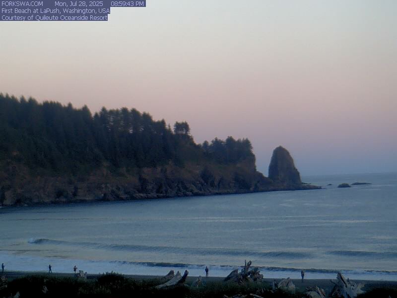
First Beach Web Cam

Why am I here and not there? (Love me them web cams...)

First Beach Web Cam, 7:20 AM, March 6, 2012 (Click for larger image.)

Other glimpses of the world out there, brought to us in our desk chairs by the magic of the Web: For PG, you're right about the snowpack in the Sangre de Cristos:

SNOTEL Map (River Basin Snow Water Content), March 5, 2012 (Click for larger image.)

Yesterday there were orcas in Port Angeles harbor again, which of course I didn't see. Didn't go out to First Beach to try to see gray whales, either. (Well ok, I had something to do and I got it done despite feeling crummy. But...) Falling down on my annual job of not-seeing whales from First Beach, need more discipline. They're coming, they're coming (1)(2). I need to be out there on the point in La Push, not seeing them.

By golly look at that. It snowed last night at only 500-whatever-feet when it rained here in town and was going plinky plinky on the drainpipes.

Glines Canyon Dam Cam, 7:32 AM, March 6, 2012 (Click for larger image.)

They're going to have to move the Lake Mills Delta Cam soon, the lake is drawn down so far you can barely see water... Hey, National Park information person, please update the Dam Removal Blog. The last entry was so-o-o-o good. #kthxbai

Saturday, March 03, 2012

Elk By The Highway In The Dark

At 11 AM we were finished with our Portland doctor business, and 4.5 hours from home if we came straight up the Interstate and then back along Hood Canal. But this was desert-dweller JK's opportunity to get to the Actual Outside Ocean on this trip, and she's driving; so it's her choice. We guessed it might take 7.5 hours to get home by the longer loop if we came up 101 on the coast, and we might be doing the last 90 minutes or so in the dark. (Actually we're wrong, it's more like 9.5 hours and a LOT of dark. Sorry, JK.) We hop in the car, find the US 26 freeway exit, and head west through the Coast Range.

We reached the coast at Seaside, Oregon, and spent a half hour on Del Rey Beach, a state recreation area. It is very very very flat. Cars drive on it. The ocean does that wonderful trick of coming ashore in waves barely two inches high...

Del Rey Beach, Oregon, February 27, 2012 (Click for larger image.)

North and north and north. Up the coast, past Astoria, climb up onto the bridge over the Columbia River, north and north and north. Along the nearly endless Willapa Bay, along the Kalaloch part of the coast at dusk. We take a little trail, look out over the ocean, admit it would be too dark by the time we found our way down to the beach to find our way back.

North north north in the dark. I knew where we were, the highway familiar by this point; for JK it was just a black tunnel. Between the Hoh River and Forks, twice there were bunches of elk right next to the highway, their beige butts and dark heads readily identifiable in the headlights. Elk! Elk! We agreed this counted as a wildlife sighting, fleeting flashing in the night though it was... Then finally home.

Started slow on Tuesday, and spent time writing up notes, making phone calls to doctors, and so on. Finally it was time for fun in the rain. We went to Salt Creek County Park. The tide was cooperative.

The tidepools at Tongue Point, February 28, 2012 (Click for larger image.)

Then we went to the other side of the park and up the trail towards Striped Peak. It was just as the trail books promise, the beautiful woods, the sound of waves, the water through the trees too gray/misty to photograph. It's been right there all this time, half an hour away, and I'd never been. Yum.

Striped Peak Trail, February 29, 2012 (Click for larger image.)

Expedition to Portland

We left spring in Port Angeles. Winter came back and went away and came back day after day. We walked around the neighborhood, read the weather forecast (dire), postponed our slow trip down the coast. Set forth on Saturday morning after another neighborhood walk,

The Bulbs Are Up In The Front Yards, Port Angeles, February 25, 2012 (Click for larger image.)

heading down Hood Canal to Olympia. Long leisurely lunch with JK's friend, Mike, after touring his backyard rain forest. Down the highway again through heavy rainshowers to a fine motel in Vancouver, WA.

Pit stop on Hood Canal: Triton Cove State Park, February 25, 2012 (Click for larger image.)

Mike had proposed Beacon Rock on the north side of the Columbia River for a Sunday morning expedition. We rolled on upriver in the morning, sweeping views and rain and snowshowers. Hiked up to the top of Beacon Rock. It was highly satisfactory, in every sense but the photographic (misty rainy snowy). Views, our daily dose of aerobic exercise, trains on both sides of the river—wooo-oo chuggachugga chugga chugga; ships on the Columbia, Bonneville Dam just upstream. Could not make out through the murk and rain where the locks were, though saw a ship heading in that direction. Wouldn't watching a big ship through the lock (1) (2) be a sight to see?

JK at Beacon Rock State Park, February 26, 2012 (Click for larger image.)

Beacon Rock is 848 feet tall. A sign on top of the rock says, "If you were standing here during the largest of the ice age floods, you would see icebergs floating in a churning mass of mud and water a mere 150' below you." Works for me. Here and there along the trail/walkway, some old railings remain. Though surely they can't date from the construction of the trail in 1918...

Beacon Rock Trail (Click for larger image.)

Then onward to a "Pacific Northwest Carcinoid Support and Advocacy Group - Oregon & SW Washington Chapter" meeting. (What, you were thinking this was a recreational expedition?) Met a number of very-long-term survivors (you don't ever meet non-survivors), learned a lot about courses of treatment and people's stories, technical language, treatment names, doctors' names, etc. Then on into Portland in the dark to a bad motel.

In the morning, appointment at the OHSU Center for Health and Healing. Consultation with super-expert doctor guy in my kind of disease. An astonishing sight out the windows of the waiting area: an aerial tram connects the CHH on the South Waterfront with an unseen main campus of OHSU up the hill somewhere.

Aerial tram, (Click for larger image.)

More in next post.

Friday, February 24, 2012

Another Cloudy Afternoon At Raymond Carver's Grave

The thing I forgot to mention last time is that it is astonishingly beautiful there. The waves loud on the cobble beach below the bluff, the green grass, the trees; Canada barely visible to the north across the Strait on such a grey day. Ships pass by.

View West, Ocean View Cemetery, February 23, 2012 (Click for larger image.)

Another retired Santa Fe librarian houseguest, another teensy expedition down the street to Ocean View Cemetery. It belongs to the city; looks and feels like history, but still in use: a new grave here, a recent date there. It is so small and quiet, from here you can imagine that the town itself is still as small as it must have been in 1894. On neither visit was a single other (living) person in the cemetery, all very still except for the sound of the waves arriving off the Strait.

Raymond Carver, RIP (Click for larger image.)


There's a columbarium there, too, but I can't imagine why you'd want your ashes locked up in a cubbyhole instead of quietly and illegally strewn just at the edge of the grass, where a friend dumping out a little container of you could see along the shore to east and west, and hear the water... Right at the moment it is not clear where else I could want my ashes to be. Where they gotta be is another question entirely.

Wednesday, February 22, 2012

Also Meant To Say

When AO and I were having our stay-local day on Sunday, we did extensive postcard shopping, then had lunch overlooking the harbor. There was a mystery military ship moored over close to the Coast Guard Station, Cape Island. The water taxi, Sealth Arrow, was flitting back and forth to it. I whipped out the iPad to look for clues on the shiptracker sites, and Cape Island didn't appear anywhere, meaning its AIS transmitter wasn't on. The next day, Peninsula Daily News explained all, with a good picture. I was going to flit down to the harbor Monday afternoon to get a photo of my own, but she had already sailed out into the ocean again.

Our stay-local stops included the postcard hunt in the native arts gallery at the Jamestown S'Klallam tribal center east of Sequim,

At Jamestown, February 19, 2012 (Click for larger image.)

and elsewhere; that lunch by the harbor; our blissed-out hours at Salt Creek County Park; a peek inside the Lower Elwha casino because she was curious about it; and Ediz Hook.

I forgot to mention in previous post that there were black oystercatchers at Salt Creek, as there often are. Yesterday Barb Blackie stopped in at the library, and last night I was thinking I should have asked her why the oystercatchers are so site-loyal to Salt Creek Park and the rocks at Tongue Point... duh... the question is the answer. Major continuous feast opportunity— world-class tidepools, for heaven's sake— why would they ever need to leave the neighborhood??

My pix of the birds did not turn out. For splendid oystercatcher visuals, try Kirsten Chursinoff's photos and fabric art. Majorly want to buy one of these. I've written to her to see if either fabric piece is still available. Have never purchased a piece of art before.

Monday, February 20, 2012

Now This Is More Like

The days are way longer, and the minus tides have shifted along the clock as well. Look out, wildlife, we have minus tides by daylight. It was dropping dropping dropping all afternoon at Salt Creek.

The tide pools at Tongue Point begin to emerge, February 19, 2012 (Click for larger image.)

There were people out everywhere, kayaking, surfing, rock hopping, heading for the tidepools even while they were still awash. Girls playing Christian rock on a little boombox and singing praise songs barefoot on the cold wet sand. People everywhere being there, actively being there.

Kayakers Passing, Canada on the Other Side (Click for larger image.)

Now. You could get out there already now, if you were young and rock-hoppy. (Click for larger image.)

We drove around to the beach access in Crescent Bay and had the exquisite pleasure of wandering out towards the little island with our feet on the emerging ground...

... (Click for larger image.)

... (Click for larger image.)

The tide pools and the little island under/surrounded by water, in posts from November and December. PS A. says I must tell you that the Jesus girls were writing inspirational messages in the sand, directives from Our Heavenly Father to be happy, to praise, to be in the sunshine...

New Toy

Oh Wave Watch III, how is it possible that I didn't know you already?

Thankies to Cliff Mass for leading me to it over the weekend, and thankies to NOAA for yet another drop-dead gorgeous tool for digital earth lovers.

Last Friday's prediction explains why AO got wet on Saturday

Is it any wonder that I treasure the NOAA email address and login which I use to do volunteer work in OCNMS' electronic documents library...? #geektothecore

Sunday, February 19, 2012

When the Whole Surface Of the Sea Is Foam

Storm: when the whole surface of the sea is foam, the wind and rain blowing. There was a High Surf Warning, so we darted for the coast despite heavy rain on the way. The wave watchers were out, but nobody lasted long in the blow along the crest of the berm at Rialto. The camera had no idea how to cope with it (nor I in the afterprocessing in the PC— sorry, you can't see how it was.)

Looking west from the point at La Push. By then AO was wet and we mostly stayed in the car... February 18, 2012 (Click for larger image.)

IJ says that's the grimmest beach photo I've ever sent her.

You can't see how it was at Rialto, February 18,2012 (Click for larger image.)

There were fishermen out after steelhead all along where highway 101 follows the Sol Duc River, that is, there were parked boat trailers and pickups, and the occasional sighting of fishermen in waders walking along the highway. We did see a sea lion working the Quileute River mouth at La Push, just a glimpse but it counts for 'marine mammal sighting'. No elk to be seen, and we looked carefully whenever passing all the appropriate prairies and grassy meadows. Also no eagles.

My poor houseguest AO, still willing and agreeable all these decades later, was blown about and cold at Rialto. Later, on First Beach, the tide was receding and the rain less, so we went walkies; but I wasn't watching out for her city-slicker self, and she got caught by an incomer where she couldn't retreat—wet to the knees up under the rainsuit, rubber mocs trashed, generally demoralized. She asked me last night, plaintively, 'Tell me again what we're doing tomorrow.' 'Walk in the 'hood in the morning, then back to the outer coast,' I said heartlessly. But I suppose I should reconsider. Depends if I am in hostess persona or tourguide persona. (Or doing what I want, which frequently works for tourguiding, but sure failed yesterday. Right now I have her bundled up in my jeans, my turtleneck, my best green sweater. Will take better care of her today, yes, whether we go to the outer coast or no.)

Saturday, February 11, 2012

Rivers, Seasons, Thankies

The dam removal blog has been gorgeously informative lately, explaining what Barnard Construction is doing, with photos from angles not shown on the fixed webcams. It includes a link to John Gussman's film clip of the explosion set off on the east corner of the dam face. Thankyous to the Park's information office, for the dam cams and the continuing flow of information.

The upper dam will continue not to have an accessible view point, even after snow melts from the Whiskey Bend Road. Good thing I went and looked from the east buttress before they began. A visual barrier has been erected just there, major fines will be levied for trespassing if you try to look. Once winter is over and the road to Whiskey Bend trailhead reopened, a tour company will be contracted to bring people to some safe spot nearby from which they will be able to see...

I sent someone a link to Tom Waits' "You Can Never Hold Back Spring", been singing it to myself ever since. Thank you, Mr. Waits, for inducing smiles since 2005, when you first gave away the song on the Web.

One of the whales down in lagoons of Baja right now is a true Wanderer, a whale named Varvara who belongs to the nearly extinct Western Gray whale population whose home waters are off Sakhalin Island. She will presumably not be one of the whales I don't see when I start going out to First Beach every week to fail to see the migration passing...

Thursday, February 09, 2012

It's Still Winter In the Alleys

Wednesday morning gray weather neighborhood walkabout, mostly in the alleys. This neighborhood has deep lots, and alleys run parallel to the number streets. It looks quite different from back there, history and people's real lives showing. Three back aspects:

... (Click for larger image.)

Two unused garages on the alley:

... (Click for larger image.)

From the street side:

The corner of 6th and H (Click for larger image.)
Flamingo Forest on 7th (Click for larger image.)
Oh look. Some are Santa Flamingos :-) (Click for larger image.)
Old bones: the mystery building at the corner of 5th and I. (Click for larger image.)

Monday, February 06, 2012

Same Bird, Different Tree

Out near Hole-in-the-Wall on Rialto Beach.


... (Click for larger image.)

Earlier in the week, COASST sent out an alert about a mini-wreck (outburst of beached birds) and a reminder of the protocol for recording large numbers of birds in a single survey,

Thanks to early reports from Third Beach, Shi Shi, and others, we're seeing an uptick of "true puffins:" Tufted Puffin, Horned Puffin and Rhinoceros Auklet on northern Washington beaches in January. For those of you around for the algal bloom in the fall of 2009 - don't panic! - this is a "mini-wreck" in comparison.
but I was not surveying, just paradin' the beach. Spent more time down near the surfline than up in the drift. But really I don't think there were any dead birds here, no puffins nor anybody else. Though they were being found to the north and south, if any had arrived on the swept-clean Rialto beaches, they were carried off or buried.

Soundscape for Cee

Sunday, February 05, 2012

Walkabout In the 'Hood

It was so sunny and crisp on Saturday, Mount Baker stood out clearly even in the middle of the afternoon. I traipsed around the neighborhood in search of an open horizon. From Crown Park (formerly Crown Zellerbach Park, one presumes, for the erstwhile owners of the paper mill below):

Near the corner of 4th and M Streets, Port Angeles, February 4, 2012 (Click for larger image.)
The Nippon Paper Mill, the harbor, Ediz Hook, the Strait of Juan de Fuca, Mount Baker white on the horizon, February 4, 2012 (Click for larger image.)

Loverly view, innit? Somewhere down there in that picture, the mill is hard at work building a biofuels plant. The locals in government and industry want the jobs, the cheaper power. Nobody seems to care about the consequences to the planet. "The pollutants that would increase are nitrogen oxide by 6 tons a year, volatile organic compounds by 36 tons a year and carbon dioxide by 231,000 tons per year..." Even the environmentalists, who have gone to court again to try to stop it, are couching their argument in NIMBY terms, the damage to our local air quality. Carbon dioxide, y'all. The plant is going to make the air around here less clear, that's true. But even if that weren't the case, how is it ok to produce all that carbon dioxide in order to save money and make jobs??

I am aware of the contradiction: we are joyfully taking down the dams on the Elhwa River to call the salmon home. The lower dam did produce clean power for some small percent of the mill's needs; but that power has already been replaced by Bonneville power— also clean— pulled out of the grid. Nippon Paper doesn't need the biofuels plant. Bonneville power is, however, part of the system of dams that kills rivers and salmon. Nothing is simple.

Quiet Days for a Shipwatcher

The big ships come and go. Mysterious things go on. Alaskan Navigator has been at the terminal having work done for more than a week. When she first appeared there, floating so high out of the water it looked like you could attach some balloons and carry her off altogether, I had to detour down to the harbor to take a look, not that being up close to her explained anything.

... (Click for larger image.)

Back behind Platypus Marine, Aleutian Spirit was 'on the hard', as David Sellars phrases it in his columns for Peninsula Daily News.

... (Click for larger image.)