Showing posts with label angelflight. Show all posts

Wednesday, November 13, 2013

Twice to Portland

While this blog was hiding under a rock, I had two trips to Portland for the monthly medical adventure. The October 6/7 trip was an Angel Flight magic carpet ride. Multo thanks to southbound pilot Norman Rittenhouse, and northbound pilot Paul Danis, and to the whole AngelFlight organization.

Port Angeles airport was fogged in all morning, so Mr. Rittenhouse suggested we fly out of Sequim Valley Airport (adding another airport to my collection of "little airports everywhere") and on down to Hillsboro. We parked at Premier Jet Fuel, and the nice fellow behind the desk in the FBO office offered me a ride down to the lightrail station, I didn't even have to make the 15-minute walk. Lightrail, streetcar, into the motel...

October 6, 2013. Sequim Valley Airport in a bubble of sunshine. Olympic Mountains on the skyline. (Click for larger image.)
In the Piper Cherokee. (Click for larger image.)
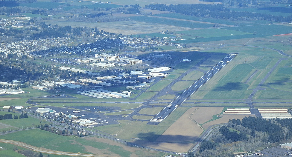
Arrival at Hillsboro (Click for larger image.)
Heading downtown on the Max Blue Line in Sunday afternoon quiet. October 7, 2013 (Click for larger image.)

In the morning: streetcar to OHSU, appointment with Big Medicine, taxicab back out to Hillsboro (time was tight), and flight back to Sequim Valley Airport with Paul Danis.We flew IFR (instrument flight rules) almost all the way, in and out of clouds, hugging the eastern margin of the Olympics. Angled down through the ceiling and there we were. Whee.

Kind of beautiful out, Hillsboro Airport, October 7, 2013 (Click for larger image.)
In the Piper Comanche (Click for larger image.)
Mountaintops appear for a moment. (Click for larger image.)
Back at Sequim. (Click for larger image.)
It was getting late. He flew away immediately. (Click for larger image.)

Thank you to Angel Flight and to my pilots, for helping make the monthly trek to Portland (and my continuing participation in the clinical trial) possible.


KF came up from Marin County for the November 3/4 trip. It was just glorious to have a friend to talk to for four days. Southbound on November 3rd, we entertained ourselves with portraits of the HammaHamma River's pair of rainbow arch bridges. KF got better pictures but I can't find them right this minute. After settling in to the motel, we took the streetcar to Powell's, spent money on a pile of books, supper in the noodle shop I fancy when making my pilgrimage to the cathedral of books, streetcar back. In the morning, November 4, the medical business (somewhat complicated this time, and a good thing I had a second pair of ears along, it had been a hard month). Then before we hit the road, a joyride to the top of the tram, which KF had heard about. Then zip for home. Explored a new exit for bathroom and food break along I-5. Once again blew past Falls View Campground along Hood Canal; one of these trips I will remember to stop and see what the Big Quilcene River looks like falling out of the mountains there.

Thanks to KF too, for making the clinical trial journey a do-able thing. I really can't do this alone.

South Hamma Hamma bridges, along Hood Canal, November 3, 2013. (Click for larger image.)
Thanks to OHSU for the free ride on the Portland Aerial Tram :-) November 4, 2013 (Click for larger image.)

Tuesday, August 13, 2013

"This Journey is a Gift from our Ancestors"

According to the photos in the camera, the following things happened since I last posted:

July 21, evening, SA arrived from Northeast Nowhere. She'd come to watch Canoe Journey land on the 23rd. We went straight from the airport out to Ediz Hook to watch the Sunday night flock of cruise ships pass. Setting the theme immediately: journeys, and water. Forgot to take pictures, but anyway you've already seen many pictures of cruise ships steaming past.

July 22 we did important local things like go to the Goodwill to get her some warmer clothes, go to the library and the post office, and eat at Toga's Soup House. All major adventures for someone from Northeast Nowhere. We went out to the tribal library to try to get a clue what time the canoes would leave Jamestown the next morning, what time the landing might begin, and spent a long time talking books and libraries with TH. I introduced SA to everyone as my first library boss, and the person who taught me what kind of librarian I wanted to be.

July 23rd, we had breakfast with JL at Smugglers' Landing, and then went down onto the beach to watch the canoes land. But word was that a canoe had overturned in heavy fog and 4-foot swells, and they had all returned to Jamestown. Arrival time entirely uncertain. So we went to the T-Pier to watch the logship Selinda begin loading, it had come in overnight. Back to the beach. It was a false rumor that the canoes had all turned back, only some had. The rest of the canoes began coming in. Five hours later it had gone on all afternoon and there were 30 of them. This will get its own blog post. (I hope. My impulse to communicate is still uncertain.)

Woman from Tulalip. Not all regalia is cedar capes and button blankets. July 23, 2013. On Hollywood Beach in Port Angeles. (Click for larger image.)

VB and ML had arrived in town also on the 23rd. They came down to watch the canoes, heard how uncertain we were about what would happen when; so went up into the Olympics to Hurricane Hill (wildflowers!); then when I called them to say the canoes were coming in, hustled back down the mountain to watch.

July 24th, the four of us went out to Rialto Beach, so they could see a wild beach on the Outer Coast.

July 28/29: Portland again. Thankyou AngelFlight.

Right along, and especially the past two weeks, I've been spending a lot of time at the tribal library, and dropping in at the college library a bit though I don't work in summer quarter. My library peeps are my support system.

Also I spend a lot of time telephoning Florida, or procrastinating telephoning Florida. Family's woes continue. My cell phone is always in my pocket, and I always know what time it is there.

Button blanket. July 23, 2013. On Hollywood Beach in Port Angeles. (Click for larger image.)

Monday, June 10, 2013

Planes and Boats and Trains

May 30th, one-day trip to Portland for the monthly medical adventure.

This was planned to be an Angelflight trip, but the weather was unstable all week and no pilot signed up for the southbound mission. At the last minute arranged to fly to Seattle on Kenmore Air, then Alaska Air to Portland. The actual tally of modes of transportation was six: car to the airport in Port Angeles, Kenmore's Cessna to Boeing Field, van shuttle to SeaTac, commuter plane to Portland, light rail from PDX to downtown, streetcar to OHSU on the South Waterfront.

Peninsula College (where I work) from the Kenmore Air flight, May 30, 2013 (Click for larger image.)

The familiar activities at the clinic building, Oregon Health and Science University's Center for Health and Healing: lab work, something to eat and some coffee, waiting to see Dr. P. up on the 7th floor, talking to doctor, interns, research assistants, the research nurse. (It's a clinical trial, you will remember. I am a science project.) Posting to twitter. Studying the view through the window wall.

Zidell Yards has started laying a new barge down there by the foot of the tramway. They made visible progress just in the couple of hours I was there. The previous barge— last seen on April 29 down on the ramp, apparently ready for launch— actually didn't set sail until May 22. South Waterfront blog has pictures. Its final paint job proclaims ST-23 a Shaver Transportation barge, and it's now on their fleet list. ST-23 will be going up and down through the locks on the Columbia River, carrying grain. Good luck to you, barge.

The Aerial Tram sails past the window wall on the 7th floor. May 30, 2013. (Click for larger image.)
Zidell Marine's new barge makes progress already (Click for larger image.)

The northbound transportation arrangements had rearranged themselves in the course of the day, with much emailing and mobile-phoning. My northbound Angelflight pilot, Jeremy, thought conditions weren't good for him to pick me up at the general aviation airport in Hillsboro (ice aloft), so he arranged a ticket for me on Alaska Air to Seattle, where he would pick me up and fly me on to Port Angeles. So the ground transportation Earth Angel, Tom, changed his plan and instead of fetching me to Hillsboro, he and his wife drove me out to PDX. I got on standby for an earlier flight than the one booked, and pretty soon was in Seattle. Jeremy met me at the curb and we headed through rush hour traffic for Renton Municipal Airport (map), where his flying club keeps its planes.

Getting ready in Renton (Click for larger image.)

Starting from someplace entirely different, the line of flight was all new territory until after we crossed Hood Canal.

Part of our line of flight. (Click for larger image.)

Then the camera lost the GPS signal, alas, so pins on the photo app stop there, and I can't tell just where we were for this random view of green Sequim hinterlands...

Sequim below, May 30, 2013 (Click for larger image.)
The log yard is filling up again; Port Angeles harbor. (Click for larger image.)

Jeremy made a featherlight landing in Port Angeles, and pulled in to Rite Brothers FBO. I walked down the way to the airport terminal, where I had left my car at 5AM, so many transitions ago it was impossible to believe it was still the same day.

Thank you to Jeremy, Tom, and Angelflight, and all the kindly people at OHSU, too.

Back in Port Angeles (Click for larger image.)

Wednesday, April 10, 2013

Little Airports Everywhere

So I had my magic carpet ride on Monday, April 1. Thankyou, AngelFlight. The morning pilot, John P., is based in Hillsboro.

My morning ride, a Cessna 182R, arriving in Port Angeles through a hole in the cloudcover, April 1, 2013 (Click for larger image.)
The Olympics from above the ceiling as we took off. April 1, 2013 (Click for larger image.)
Mount Olympus (Click for larger image.)

John came with a friend, Tod J., in the co-pilot seat; they talked the whole way about aviation electronics and the radio traffic and so on. There was low overcast almost all the way, couldn't see the ground (except for the Olympics showing off above the clouds; and the log yard and Morse Creek through a hole in the clouds before the ceiling closed in again).

The log yard, and the Morse Creek curves on US 101, Port Angeles, April 1, 2013 (Click for larger image.)

Then no ground visible until almost to Hillsboro, where we did NOT land at HIO (Portland/Hillsboro)

Portland/Hillsboro General Aviation Airport (HIO) where we did not land (Click for larger image.)

but at a weentsie airfield a few miles to the south called Twin Oaks Airpark (airport code 7S3). We seemed to just come down and land in the middle of farm fields, then taxi'd up a steep driveway and parked the plane in what seemed to be (and apparently was) the front yard of the owners. There are little airports everywhere. Who knew? Nice aerials on their website.

At Twin Oaks Airpark (Click for larger image.)
John and Tod at Twin Oaks (Click for larger image.)

John P.'s car was at Twin Oaks, and he completed the magic carpet effect by himself driving me into town to OHSU. He knew exactly which way to go.

Then the usual at OHSU: lab work, waiting by the entertaining 7th floor window wall (construction everywhere, no mountains visible, the tram moving up and down, checking on the progress of Zidell Marine's barge), appointment with Dr. P. As always, he was interested in the travel arrangements. I showed him a photo of John P.'s Cessna Skylane; before he moved on to the next patient, he darted off to check the aviation weather, came back to assure me that conditions were much better and the ceiling higher both at Hillsboro and in Port Angeles. After appointment, I took the streetcar

Zidell Marine's new barge as seen from near the streetcar stop at OHSU, April 1, 2013 (Click for larger image.)

and lightrail back out to Hillsboro,

MAX leaving the Fair Complex/Airport Station in Hillsboro (Click for larger image.)

walked over to the airport, and met my afternoon pilot, John V. He works for Boeing, keeps his plane in Renton (Seattle area). Much better ground visibility on the return, a smooth cheerful flight.

Chehalis River and I5 (Click for larger image.)

I was home,

The spit at the mouth of Sequim Bay, Sequim, WA. Eighth Street bridges over Valley Creek and Tumwater Creek, Port Angeles (Click for larger image.)
John V. with his Cessna 210N, Port Angeles (Click for larger image.)

back in my desk chair, not quite 8 hours after I left and not bored for a minute. Ten thousand thankyous to John, Tod, John, and AngelFlightWest.

For aircraft geeks. Inside the T210N

Thursday, February 07, 2013

Portland Again Again

Two days devoted entirely to modes of transportation, with an interlude in the arms of Big Medicine.

Flew south in cloudy overcast foggy sorts of weather: from Port Angeles on Kenmore Air's Piper Chieftain to Boeing Field in Seattle,

In the Piper Chieftain, February 3, 2013 (Click for larger image.)

van to Seatac, Alaska Air to Portland,

Best view ever of Mount Saint Helens, from the Alaska Air flight; always sit on the Cascades side of the plane, just in case. February 3, 2013 (Click for larger image.)

light rail (MAX) to the motel. Streetcar to Powell's.

The Mother Church for book people, Powell's City of Books (Click for larger image.)

In the morning, streetcar to OHSU

Portland Streetcar N-S Line at sunrise, February 4, 2013 (Click for larger image.)

to be examined by my clinical trial doctor (I'm still a science project), at the Center for Health and Healing—airy name notwithstanding, a 13-story building full of suffering people (and that's all I'm going to say about that). After the appointment, streetcar to the light rail station at City Center,

MAX signage always tells you when the next two trains will arrive (Click for larger image.)

lightrail to Portland-Hillsboro general aviation airport. Hillsboro Aviation's FBO is a 10-minute walk from the MAX station. I just cheerily rolled my roller-bag up the sidewalk and was there.

Waiting at Hillsboro (Click for larger image.)

AngelFlight home to Port Angeles through murky skies on a Cessna T182T Skylane. Not good camera conditions, but I clicked the shutter all the way, just to keep paying attention.

The mouth of the Columbia River, out to the west (Click for larger image.)

Approaching Port Angeles, we had to descend through the overcast below us,

Descending into the cloud, the Olympics disappearing (Click for larger image.)

sliding slowly downward buried in the cloud; then once under the ceiling, looped out to approach the runway from the west. Got a good view of the Lower Elwha Klallam Reservation which is so familiar to me from the ground, and an oblique glimpse of mouth of the Elwha at the edge of the rez, already much reshaped by the sediment coming down the river from the dam sites.

Elwha. No point in artificially straightening the view, the plane was tilting :-). The river mouth on February 4, 2013 (Click for larger image.)

Thankyou to my pilot Hunter Handsfield, and to AngelFlight, for getting me delivered to the airport practically on my own doorstep with such wonderful ease.

Arrived in Port Angeles, February 4, 2013 (Click for larger image.)