Showing posts with label ships. Show all posts

Tuesday, August 13, 2013

"This Journey is a Gift from our Ancestors"

According to the photos in the camera, the following things happened since I last posted:

July 21, evening, SA arrived from Northeast Nowhere. She'd come to watch Canoe Journey land on the 23rd. We went straight from the airport out to Ediz Hook to watch the Sunday night flock of cruise ships pass. Setting the theme immediately: journeys, and water. Forgot to take pictures, but anyway you've already seen many pictures of cruise ships steaming past.

July 22 we did important local things like go to the Goodwill to get her some warmer clothes, go to the library and the post office, and eat at Toga's Soup House. All major adventures for someone from Northeast Nowhere. We went out to the tribal library to try to get a clue what time the canoes would leave Jamestown the next morning, what time the landing might begin, and spent a long time talking books and libraries with TH. I introduced SA to everyone as my first library boss, and the person who taught me what kind of librarian I wanted to be.

July 23rd, we had breakfast with JL at Smugglers' Landing, and then went down onto the beach to watch the canoes land. But word was that a canoe had overturned in heavy fog and 4-foot swells, and they had all returned to Jamestown. Arrival time entirely uncertain. So we went to the T-Pier to watch the logship Selinda begin loading, it had come in overnight. Back to the beach. It was a false rumor that the canoes had all turned back, only some had. The rest of the canoes began coming in. Five hours later it had gone on all afternoon and there were 30 of them. This will get its own blog post. (I hope. My impulse to communicate is still uncertain.)

Woman from Tulalip. Not all regalia is cedar capes and button blankets. July 23, 2013. On Hollywood Beach in Port Angeles. (Click for larger image.)

VB and ML had arrived in town also on the 23rd. They came down to watch the canoes, heard how uncertain we were about what would happen when; so went up into the Olympics to Hurricane Hill (wildflowers!); then when I called them to say the canoes were coming in, hustled back down the mountain to watch.

July 24th, the four of us went out to Rialto Beach, so they could see a wild beach on the Outer Coast.

July 28/29: Portland again. Thankyou AngelFlight.

Right along, and especially the past two weeks, I've been spending a lot of time at the tribal library, and dropping in at the college library a bit though I don't work in summer quarter. My library peeps are my support system.

Also I spend a lot of time telephoning Florida, or procrastinating telephoning Florida. Family's woes continue. My cell phone is always in my pocket, and I always know what time it is there.

Button blanket. July 23, 2013. On Hollywood Beach in Port Angeles. (Click for larger image.)

Monday, June 10, 2013

Planes and Boats and Trains

May 30th, one-day trip to Portland for the monthly medical adventure.

This was planned to be an Angelflight trip, but the weather was unstable all week and no pilot signed up for the southbound mission. At the last minute arranged to fly to Seattle on Kenmore Air, then Alaska Air to Portland. The actual tally of modes of transportation was six: car to the airport in Port Angeles, Kenmore's Cessna to Boeing Field, van shuttle to SeaTac, commuter plane to Portland, light rail from PDX to downtown, streetcar to OHSU on the South Waterfront.

Peninsula College (where I work) from the Kenmore Air flight, May 30, 2013 (Click for larger image.)

The familiar activities at the clinic building, Oregon Health and Science University's Center for Health and Healing: lab work, something to eat and some coffee, waiting to see Dr. P. up on the 7th floor, talking to doctor, interns, research assistants, the research nurse. (It's a clinical trial, you will remember. I am a science project.) Posting to twitter. Studying the view through the window wall.

Zidell Yards has started laying a new barge down there by the foot of the tramway. They made visible progress just in the couple of hours I was there. The previous barge— last seen on April 29 down on the ramp, apparently ready for launch— actually didn't set sail until May 22. South Waterfront blog has pictures. Its final paint job proclaims ST-23 a Shaver Transportation barge, and it's now on their fleet list. ST-23 will be going up and down through the locks on the Columbia River, carrying grain. Good luck to you, barge.

The Aerial Tram sails past the window wall on the 7th floor. May 30, 2013. (Click for larger image.)
Zidell Marine's new barge makes progress already (Click for larger image.)

The northbound transportation arrangements had rearranged themselves in the course of the day, with much emailing and mobile-phoning. My northbound Angelflight pilot, Jeremy, thought conditions weren't good for him to pick me up at the general aviation airport in Hillsboro (ice aloft), so he arranged a ticket for me on Alaska Air to Seattle, where he would pick me up and fly me on to Port Angeles. So the ground transportation Earth Angel, Tom, changed his plan and instead of fetching me to Hillsboro, he and his wife drove me out to PDX. I got on standby for an earlier flight than the one booked, and pretty soon was in Seattle. Jeremy met me at the curb and we headed through rush hour traffic for Renton Municipal Airport (map), where his flying club keeps its planes.

Getting ready in Renton (Click for larger image.)

Starting from someplace entirely different, the line of flight was all new territory until after we crossed Hood Canal.

Part of our line of flight. (Click for larger image.)

Then the camera lost the GPS signal, alas, so pins on the photo app stop there, and I can't tell just where we were for this random view of green Sequim hinterlands...

Sequim below, May 30, 2013 (Click for larger image.)
The log yard is filling up again; Port Angeles harbor. (Click for larger image.)

Jeremy made a featherlight landing in Port Angeles, and pulled in to Rite Brothers FBO. I walked down the way to the airport terminal, where I had left my car at 5AM, so many transitions ago it was impossible to believe it was still the same day.

Thank you to Jeremy, Tom, and Angelflight, and all the kindly people at OHSU, too.

Back in Port Angeles (Click for larger image.)

Sea Voyage to Another Country (Again)

May 24th, went over to Victoria to hang out with PW and WC. It was a beautiful morning for the crossing.

May 24, 2013. Port Angeles from the stern deck of the ferry. Looking good. (Click for larger image.)
Still sunny when we got to the other side. Victoria Harbor, May 24, 2013 (Click for larger image.)

Usually we drive west along the West Coast Road, it's a reflex: 'I dunno, why don't we head out to French Beach, maybe we could have a fancy dessert at the Point No Point Inn and look across the Strait to Clallam Bay, ooh, shall we go to Jordan River.' This time instead we went not west but north, where Victoria proper backs up into the Saanich Peninsula and becomes Greater Victoria. We went to Quick's Bottom Park and took a walk. It's a wetland, it was quite preposterously green. Managed to find the decrepit old bird blind, though it was midday and not many birds to see (and no pix). We ventured onto back roads.

Quick's Bottom, Saanich, BC. May 24, 2013 (Click for larger image.)

The next day we set forth in search of Gowlland Tod Provincial Park. It was rumored to be an easy walk to Tod Inlet. We trundled down a ways along the slope below where Butchart Gardens is, then came to a trail sign that made clear there was much further to go, and besides it was thinking about raining, so we turned back.

Random woodsiness on the trail to Tod Inlet, May 25, 2013 (Click for larger image.)

We had lunch in Brentwood Bay, while it absolutely poured down rain into the marina and on all the decks of the restaurant. Then explored local roads. Went out to Willis Point, wherever that is (by then I was turned around 180 degrees, thought we were looking east when we were looking west).

The end of the road at Willis Point, where the houses run out and by golly there's a boundary sign for Gowlland Tod Provincial Park. Where for heaven's sake were we? (Click for larger image.)

A rest, a quick stop to say hello to one of PW's daughters at her downtown job, and I was back on the ferry for the journey home. As usual, took several dozen photos of water taxis while the ferry loaded; also seaplanes, tall ships, cruise liners. It started raining again halfway across the Strait.

The Coho coming in (Click for larger image.)
(Click for larger image.)
The flock of cruise ships that will leave before midnight, arrive in Seattle the next morning, and set sail again at 4PM. (Click for larger image.)

The bottom pins are Victoria harbor. The one to the east, WC & PW's yard. In the middle of the peninsula, Quick's Bottom by the highway 17 sign, Tod Inlet righthand upper pin, Willis Point to the left.

(Click for larger image.)

Monday, May 20, 2013

Logship, Fisherguys, BigShips

Saturday remained a watercraft day. Went out twice more, first time down to the harbor to check on the loading of Astoria Bay. There was more simultaneous activity than I've ever seen at one of the logships, two loaders taking logs off two trucks at a time, seven or eight trucks lined up at once waiting to drive out onto the pier. Brakes puffing, engines rumbling, each truck hitting its horn when it is in position and all brakes set, ready to have its load lifted away.

May 18, 2013, Terminal 3 (the T-Pier) at the Port of Port Angeles. (Click for larger image.)

The whole process is mesmerizingly tangible, like watching a giant set of gears in some steampunk fantasy, and I love to watch it. The end result, of course, is that a couple of days later, a whole forest sails away to China.

...

Back home for a couple of hours, I kept my eye on the clock, and on the shiptracker websites, and when the evening's flock of cruise ships rounded Point Wilson, at Port Townsend, I went down to Ediz Hook (map) to wait for them to pass by on their way to Alaska. It is a reliable entertainment for summer weekend evenings; every Friday Saturday and Sunday, these ships bigger than all downtown leave Seattle at 4PM, come in close to the Hook around 7:30 PM, one two three, so the pilot boat can go out to pick up the pilots who brought the ships out of Puget Sound; and away they sail for Alaska. In a week they'll be back, and do it again. May through September, over and over.

But I was early, Westerdam, Jewel and Star were not yet in view, and there was a whole lot of action on the small boat docks inside the Hook. These were the guys whose boats were not sitting around in the alley a few hours ago. Mostly they hadn't caught anything. One man said his son had caught a small halibut. One after another they hauled up the ramp and headed for town.

Returning fishermen, Ediz Hook, Port Angeles Harbor, May 18, 2013. The tanker Polar Enterprise and the bulk freighter Pacific Logger in the background of the images. (Click for larger image.)

I waited a while. Other shipwatchers came and went. There were two tankers and an empty log ship anchored inside the harbor. There were freighters and tankers on the move on the Strait.

It got blue out.

Victoria, Vancouver Island, BC, across the Strait of Juan de Fuca (Click for larger image.)
San Juan Island (US), across the Strait. (Click for larger image.)

The pilot boat Juan de Fuca, pulled out from the pilot station

Puget Sound Pilot Station (Click for larger image.)

and ran around furiously out on the Strait. Took pilots off two outbound ships, a freighter and a tanker. Came back in, dropped off those guys, went out again. Put pilots on two inbound ships, a container ship and a tanker; then, finally, rendezvoused with Holland-America Westerdam, Norwegian Jewel, and Star Princess, one after the other, to bring in their pilots.

Westerdam, with the other two cruise ships visible behind her. The Holland Americas all have white tops and dark bottoms, and are smaller than the others. (Click for larger image.)
Norwegian Jewel. The Norwegians all have goofy colorful paint jobs on either side of the bow. (Click for larger image.)
Star Princess. The Princesses are all white with a blocky stern and that sort of swooping crown over the logo on the stack. (Click for larger image.)

Saturday, May 04, 2013

Journey North Says, and Other Updates

Shoutout to @jfleck , who writes about water and climate at the Albuquerque Journal, for this new-to-me visualizer, the WPC Quantitative Precipitation Forecasts. I really shouldn't complain, but it's relentlessly sunny here right now. My inclination is to cower indoors.

Journey North's Gray Whale section says it's "rush hour for moms and babies". Since I'm not going to get out to La Push at a low tide before I have to head for Florida again, that will have to do for whale news. For not-news, look again at the post about seeing a whale on April 21.

Work on the Elwha River's dam removal project is stopped for at least another month while the National Park and the contractors and the city and the tribe and other water users sort out the sad fact that the new water treatment plant and all its intake works were underdesigned and have been overwhelmed by silt and debris coming down the river from behind the former dams. It's more fun to think about the ever-changing re-making of the river itself and the nearshore. Once again Tom Roorda has been way up in the middle of the air looking at it, and sharing what he sees. New land continues to grow on the rez side of the river.

The Elwha River flows into the Strait, May 1. Thank you to Tom Roorda for permission to show this image. (Click for larger image.)

Did I mention the days are long?

Saturday
4 May 2013 Pacific Daylight Time
SUN
Begin civil twilight 5:15 a.m.
Sunrise 5:50 a.m.
Sunset 8:32 p.m.
End civil twilight 9:08 p.m.

It's starting to melt up on Hurricane Ridge, but there's still a lot of snow up there and on into the high country. Will the Obstruction Point Road open for July 4th weekend? Seems unlikely; last year it wasn't open until the middle of August. I stare at the lines on the graph and try to guess.

Snow-Water Equivalent at the Waterhole Snotel, May 4, 2013 (Click for larger image.)

Went to Portland on April 29. The daylight is long, we did it as a day trip. Drive drive drive, lab work, consult clinical trial doctor, drive drive drive some more, back home again. I'm still stable, still in the trial. There was big news for a shipwatcher: Zidell Marine's current barge under construction, which I've been watching month by month from the windows of OHSU, seems to be finished. All fresh paint, and waiting down on the ramp leading into the Willamette River. It's now five days later, but either it hasn't launched yet, or the Portland news sites aren't reporting on her launch. She's not listed yet on the amazingly long list of barges Zidell Yards has built in its various incarnations, presently Zidell Marine.

Zidell Marine's barge ST 23 from the windows of the lab on the 3rd floor of OHSU, April 29, 2013 (Click for larger image.)
...from the windows of the oncology waiting area, 7th floor of OHSU, April 29, 2013 (Click for larger image.)

Thursday, March 21, 2013

Shipwatching (Recollected)

Thursday, March 21. Spring break at the college began at 4 in the afternoon, and PG arrived from Santa Fe shortly afterwards. She requisitioned a nap, and then to go out on Ediz Hook. (I thought the nap was because she gotten a bit lost near SeaTac and near Poulsbo, and it was longer driving out here than expected. Turns out the nap was because she was on vacation and naps were an important part of her itinerary.) Tankers galore in the harbor, two Polars and two Alaskans. Conditions were not best for observing ship details out on the Strait, kind of misty out there to the north, but we managed to identify sundry ships, inbound and out, with the help of the iPad and marinetraffic.com. They had entertaining names, especially Grand Dahlia, and Glorious Maple. Okasana had such a baffling silhouette it took forever to figure out what we were seeing. What she was seeing, actually: PG's eyes and binoculars are much better than mine.

March 21, 2013. Looking south across Port Angeles Harbor to Klahane Ridge. (Click for larger image.)
Only one pilot boat was visible. The other was... somewhere. (Click for larger image.)
Look north across the Strait of Juan de Fuca. (Click for larger image.)

PS After much dithering about the question, have decided to date these posts about PG's visit on the days they happened, so they will file correctly; rather than the day written, as much as 10 days later.

Sunday, December 23, 2012

The Watcher of Ships Watches Some Ships

Light mostly gone. Thank heavens the sunsets are going to be later now, I am done with darkness. Went out on Ediz Hook (map).

Vancouver Island on the other side of the Strait of Juan de Fuca, December 23, 2012 (Click for larger image.)

The submarine escorts (technically, offshore supply vessels) HOS Arrowhead and HOS Eagleview came in off the Strait. They always travel in pairs. It used to be Silverstar and Gemstone, but those two are no longer listed. Where have you gone, Silverstar?

HOS Arrowhead (Click for larger image.)

There were three big ships at anchor out in the harbor, the tankers Polar Discovery and Alaskan Frontier—the Polars and the Alaskans are often here, either just anchored and waiting for a day or two, or tied up at one of the piers sometimes for weeks, getting service done—and something more unusual that I couldn't get an angle on to photograph. The shiptracker sites say she is Prabhu Jivesh, an Indian ship. I can only think of one other time there was a ship from India...

Polar Discovery in Port Angeles Harbor (Click for larger image.)

There were three boat trailers parked by the small boat docks when I got out there, and a woman from Washington Department of Fish and Wildlife sitting in her pickup waiting. All three came in while I was hanging around; only one of the boats had caught anything. "A small blackmouth," said the fisherman. The WDFW lady took her clipboard out on the dock and measured the fish. Blackmouth is a winter Chinook salmon, not yet mature to begin its spawning run.

Alaskan Frontier, and a small recreational fishing boat (Click for larger image.)
The Olympic Mountains emerge briefly (Click for larger image.)

Saturday, October 20, 2012

Pale Green Tanker

The pale green tanker which has been sitting in the harbor all week is the BW Seine. It looks like she's full. No doubt there's a story there.

... (Click for larger image.)

Meanwhile, we've had some more rain, and the flow in the Elwha River hopped up. Lots more silty water going over the Glines Canyon Dam.

Yesterday's Dam Cam, Showing Guys at Work (Click for larger image.)

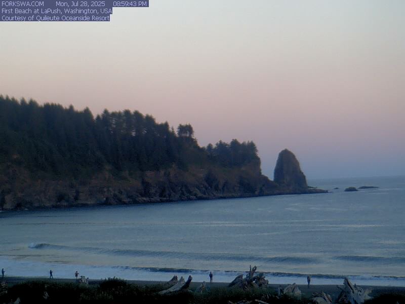
Finally there may be enough water in the rivers to lure the salmon upstream. I guess I better go take a look at Salmon Cascades. (Later: ocean first, Salmon Cascades after. The First Beach Webcam is calling me, calling me.)

First Beach Right Now, Thank You Webcam (Click for larger image.)