Tuesday, November 29, 2011

Processes

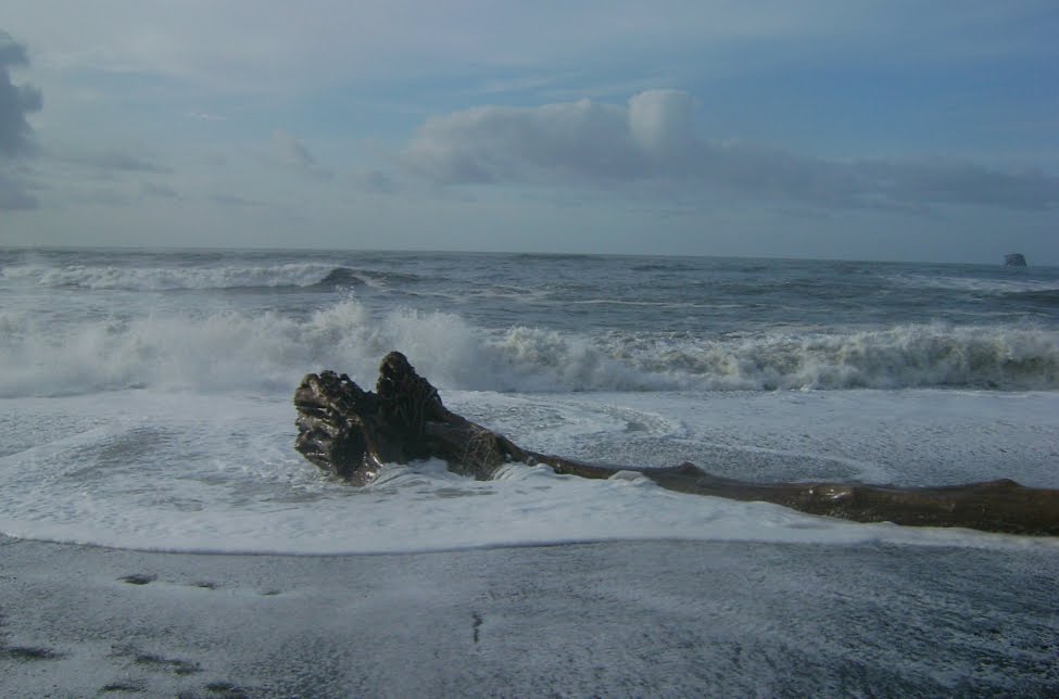
Monday. Over a couple of hours, the weather cleared, the tide crested, the swell subsided. It wasn't nearly as wild as I'd hoped, and the surf never washed over the top of the berm. I was watching one particular log to see if it would move at the height of the tide. Move yes, wash-away not.

Rialto Beach, about 2 hours before high tide, November 29, 20111 (Click for larger image.)
Later (Click for larger image.)
Soundscape for Cee
More soundscapes

Later we went around to the La Push side of the river and sat for a while on the point, looking sometimes towards First Beach, sometimes back north (the river, the boat harbor, Rialto Beach beyond), sometimes straight out west.

Jayden Bay coming out of La Push harbor, September 29, 2011 (Click for larger image.)

Same image, closer up; notice Hole-in-the-Wall at the far end of Rialto Beach in the distance... (Click for larger image.)

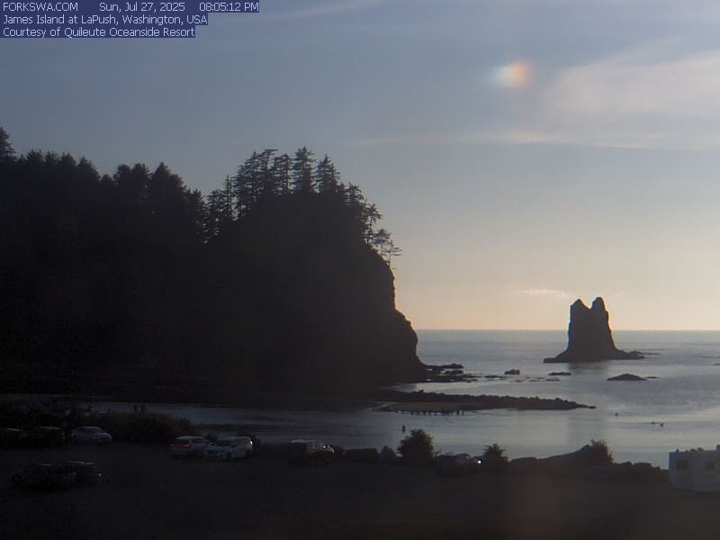
Jayden Bay heading out towards the Quileute River mouth, James Island behind her (Click for larger image.)

Monday, November 28, 2011

King Tides

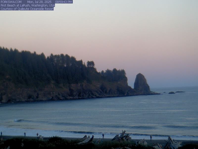
Presently contemplating the weather report and the tide table. Going to the ocean today, yes for sure, but can't probably get down on the beach because of very high tide at the wrong time of day. Will be limited to watching and listening to the power of the incoming swell. Eee too bad, the ocean will not bend to my convenience; when I want surf to experience sometimes I get boring beach. Today I want boring beach and will get surf to watch. :-)

First Beach WebCam at the moment, November 28, 2011 (Click for larger image.)

Monday, November 21, 2011

Sunny Day for Two

Saturday had the best weather forecast all week, so we planned it for our beach day despite snow on the deck and a snow shower over the Strait at dawn. It began to lighten up, forecast remained steadfast in its certainty that we would have some sun at the ocean. PH and I started assembling lunches and gear, and headed west.

November 19, 2011, morning. Storm has passed by... (Click for larger image.)

Lake Crescent was showing off.

November 19, 2011. Lake Crescent, mid-morning (Click for larger images.)

No elk on Beaver Prairie. But yes, sunshine at the beach. (We have no idea what the day may have been doing back here in town. We were out there.) We devoted ourselves to sitting on a log, reading our books and eating our lunch and taking pictures now and again. The tide finished going out, then began coming back in again.

Rialto Beach (Click for larger images.)

We stopped at the overlook by the river to look for seals, ducks, or eagles. Out of consideration for PH's un-electronic sensibilities, I did not take advantage of the good signal there to fire up the iPad, check email and twitter. PH spotted an eagle sitting down in the river, its white head moving about. It shifted to a branch sticking up out of the water, then flew stately across our field of view and disappeared into the trees on the other side of the river. I wanted credit for having manifested the eagle as well as the sunny day; PH thought she got the credit for having manifested the eagle, since she spotted it.

Then we drove around to La Push and parked out on the point for a while.

From La Push, looking south along First Beach, the view where I didn't see whale #1 all last season, and not for lack of trying (Click for larger image.)
From La Push, looking west (Click for larger image.)
From La Push, looking north. Little James Island, Quileute River. That's Rialto Beach over there beyond the jetty (Click for larger image.)

No elk on Beaver Prairie on the return journey either. As we got closer to town it looked like there may have been fresh snow showers.

Saturday, November 19, 2011

Staying Local, in Eight Stops

Continuing the pursuit of distractions. GF came over from Seattle on November 12, (now a week ago). The weather was not ideal— and anyway he wanted to see what could be seen of the dam removals— so we stayed hereabouts, in the rainshadow. I contrived never to set wheel on US 101. US 101 being almost all he knew of this area, it was every-mile-new for him.

We took a look at the airport terminal, because he was charmed by how close the airport is to my house. ('If it were me I'd walk there wheeling my suitcase at least once, just because,' he said.) Then we went to the overlook for the Elwha Dam. No work seemed to be happening, well it was a Saturday and we are in the 'fish window' where no work can go on which might add to the silt settling over the redds, the salmon nests, in the first five miles of the river. I waved my arms around a lot explaining about the temporary channel where the river now flows, and the plan to return the river ultimately to the old channel on the other side. The dam cams, by the way, don't show much action because of the fish window, but yaay the slide shows are now offered in both java and html5 so you can watch 'em on an iPad, w00t! The upper dam, the Glines Canyon Dam, being out of reach until the Whiskey Bend Road reopens, we moved on.

Elwha Dam, November 12, 2011 (Click for larger image.)

Since we were already on WA 112, the next stop was westward along the highway, to Salt Creek County Park. First we went to the parking area down by Crescent Beach at the east side of Salt Creek where the land belongs to the County Park. It was high tide, the swell off the Strait was rolling right up the creek almost to our feet, and the parking area was full of surfers drinking coffee from thermoses. Why are you surfing here, we asked. Because the swell on the outer coast is too dangerous. But I was at Rialto yesterday and the swell was very mild, I said. It built during the night from the big storm off Alaska, said the surfer. For some reason it pleased me greatly to rub shoulders with this other school of ocean-watching, people who are tracking the build of the swell in the dark of night, turn up for high tide along the Strait...

Bad pic of waves rolling right up the creek and into the marsh at our feet, Salt Creek County Park, November 12, 2011 (Click for larger image.)

Then on to the picnic area at the back of the campground in the Park itself, which overlooks Tongue Point. Except Tongue Point was almost completely under the waves. We went to the bottom of the stairs. Waves were splashing up to them. There were harlequin ducks, and black oystercatchers, bufflehead. Not a whole lot else in the way of seabirds, or anyway the water too wild to see them. Before leaving the park we took the trail along the bluff edge and up to the bunker (this being in fact an old WWII coastal defense installation). Along the trail, a perfectly spectacular mystery fungus growing from a stump.

Tongue Point under the waves (Click for larger image.)
Little island at Salt Creek, surrounded by waves (Click for larger image.)
Mystery fungus. Identifications cheerfully accepted. (Click for larger image.)

(Tongue Point not under the waves, June 2009). (Little island not surrounded by waves, February, 2011.)

OK then, back on the Elwha River exploration track. We went to the cobble beach at the river mouth. Surfers, but the tide was falling and the breakers not too impressive. We walked on the pedestrian-and-bike deck of the new high bridge, where I got to wave my arms around again pointing to the water plant and detailing all the industrial infrastructure investment which had to be in place before the first bite was taken out of either dam. We went down to the end of Lower Elwha Road on the rez and looked at the river from just inside the mouth.

Cobble Beach at the mouth of the Elwha River (Click for larger image.)
Looking toward the Strait and the river mouth from the end of Lower Elwha Road (Click for larger image.)

The light was fading. We hustled on out to Ediz Hook, saw ducks, watched the pilot boat go out to meet a ship (whose name I have lost), rendezvous, return to its berth. The weather was breaking up. Blue patches and peekaboo mountains.

... (Click for larger image.)

Then GF headed back to Seattle in the dark.

Saturday, November 12, 2011

The Elk Were Out

Friday we pretended we didn't care about the weather forecast, and IJ and I went out to the ocean to see the places I write about. We did very well as to weather, waves, and wildlife. There was pouring rain along the highway as we headed west, but it lightened up once we were on the outer coast. It was high tide when we got out there, so we couldn't get down on the beach at Rialto, but perched in the drift watching the waves and the ever-changing light between the rainshowers.

Rialto Beach, with James Island, November 11, 2011 (Click for larger image.)
Soundscape for Cee (with IJ's Rainsuit)

A strong rainshower chased us back to the car, and we drove around to the south side of the mouth of the river. We parked out on the point in La Push overlooking First Beach, where we'd see whale blows in March or April if we had better luck than I usually do. It was extremely windy, we stayed mostly in the car. There were tiny sunbreaks. There was an eagle over the channel, who went behind James Island before IJ could spot him.

Looking west from La Push, November 11, 2011 (Click for larger image.)

Here is the best part. IJ very much wanted to have me point out Beaver Prairie, where I sometimes see the elk in winter. They hadn't been around yet, I said, so she had no expectations. But there they were. She counted at least fifty. It was raining, the rain was coming in the car window, the camera jumped; but here by golly are some of our blurry elk.

Elk on Beaver Prairie, November 11, 2011 (Click for larger image.)

Tuesday, November 08, 2011

Swans, Anemones, and So On

Sunday we went out to Neah Bay. That way we were seeing new territory for PG, and it's all the same ocean as long as it's the outer coast. :-) Stopped to duck-watch near the harbor in Neah Bay, and then on out to Hobuck Beach. (Sam Beebe's glorious aerial photo shows everything: Hobuck Beach in the foreground, Wa'atch River, Neah Bay on the near side of the Strait, then the Strait with Vancouver Island behind.) The tide was going out.

Sunny Mid-Day, Neah Bay, November 6, 2011 (Click for larger image.)

It's really quiet out there, compared to the wild high-energy feeling of Rialto Beach, for all that it is the same ocean. PG asked me, "What's straight out there?" pointing perpendicular to where we stood, compass bearing west in intention if not in fact. We had to wait until we got home for the answer, looking on the big globe. Straight west is Sakhalin Island, not Japan as it is in everyone's imagination.

(Click for larger image.)
Barely a Soundscape, for Cee

The tide was going out all afternoon. We wandered. We didn't have the bird survey pack with us, but found three beached birds and looked at one very carefully, trying to retain enough information without ID book, measuring tools, etc to identify it when we got home. (Maybe pigeon guillemot, we think, just like the living mystery bird we had the day before at Ediz Hook.)(Later: sent the dead-bird photos to JL, my beached-bird mentor; she says the one we looked closely at was a common murre.) There were fish skeletons, mounds of kelp, lots of limpets and sand dollars. Hobuck is an accumulation beach, what arrives there stays there. I found a chiton plate, the first I have found on my own without a beach companion spotting it and giving it to me, since I'm known to be mad for chitons.

When we returned to our starting point, the tide was well out, and we could look for tidepool critters.

Where the anemones were (Click for larger image.)
Only a couple of sea stars (Click for larger image.)
Lots of anemones and barnacles (Click for larger image.)

It was the day of the time change. We kept track of our time, so we could make the two hour return part of our driving loop in daylight and PG could see more new territory. Along the Wa'atch River just behind the beach, the swans were there. They must winter there, you can often hope to see them. OMG they are so beautiful. We watched them for quite a while. I didn't try for a photo, it wouldn't have come out.

Birthday Portrait; I am holding an enormous sand dollar that PG hoped to get home intact in her tiny overstuffed carryon luggage. (Click for larger image.)

Saturday, November 05, 2011

Not-a-Duck

Accumulating distraction reports: On Wednesday took PG out to Salt Creek County Park. The tide was coming in, she couldn't really see how Tongue Point emerges from the Strait covered all over with kelp and tidepools. There were lots of harlequin ducks, and some black oystercatchers (lo-o-o-o-ve oystercatchers). Also merganser, an eagle, a grebe, some cormorants.

Then we went on out to Ediz Hook. There were great blue herons, a loon, buffleheads, sanderlings, dunlin, lots of wigeons, a red knot (unusual; we had trouble believing we had it but we did). Also lots of harbor seals hauled out on a log raft.

Tongue Point going under the waves, November 2, 2011 (Click for larger image.)
Island in green water, Salt Creek County Park (Click for larger image.)
Great Blue Heron on the boom by the pilot station. Port Angeles beyond. (Click for larger image.)

Friday we went to the ocean. The forecast was for clouds but instead we had a day like this:

Rialto Beach, November 4, 2011 (Click for larger image.)

Stupid blogger changed the interface, I have to reload these, but for now...

Soundscape for Cee
At Ellen Creek (Click for larger image.)
The 360

Saturday evening, back out on the Hook, lots of ducks and a not-a-duck. Some experienced birders also couldn't figure it out. This morning PG thinks maybe it was a pigeon guillemot. Also we had scoters, wigeons, buffleheads, mergansers, harlequins, and not a single eagle.


November 5. American wigeons in Port Angeles Harbor (Click for larger image.)
November 5. Klahane Ridge and Mount Angeles emerge above Port Angeles (Click for larger image.)

Monday, October 31, 2011

Looking at the Work

On Thursday went with W. to the second overlook for the Elwha Dam removal. We spent a long time there, watching red and yellow backhoes chew up the old stepped spillway which occupies the river's original channel, and move dirt around. Trucks moved out load after load of rubble and dirt, bringing it to a staging area right by where you park to get on the trail. From there a different fleet of trucks is carrying the rubble off to elsewhere.

Watching the work on the dam, October 27, 2011 (Click for larger image.)

Go to the dam webcams and click on webcam slideshow, then tell it to go forward instead of back. Forward takes you to the beginning of the sequence, before the removal began...

What It Looked Like on the Webcam Before Deconstruction Started, August 24, 2011 (Click for larger image.)

They are repairing the Whiskey Bend road, and even hikers can't go up there. No way to get near the upper dam, Glines Canyon, probably until spring, as snow will close the road before repairs are completed; and we won't be able to approach from the other side until the project is completed.

Tuesday, October 25, 2011

The Vine Maples on the West End

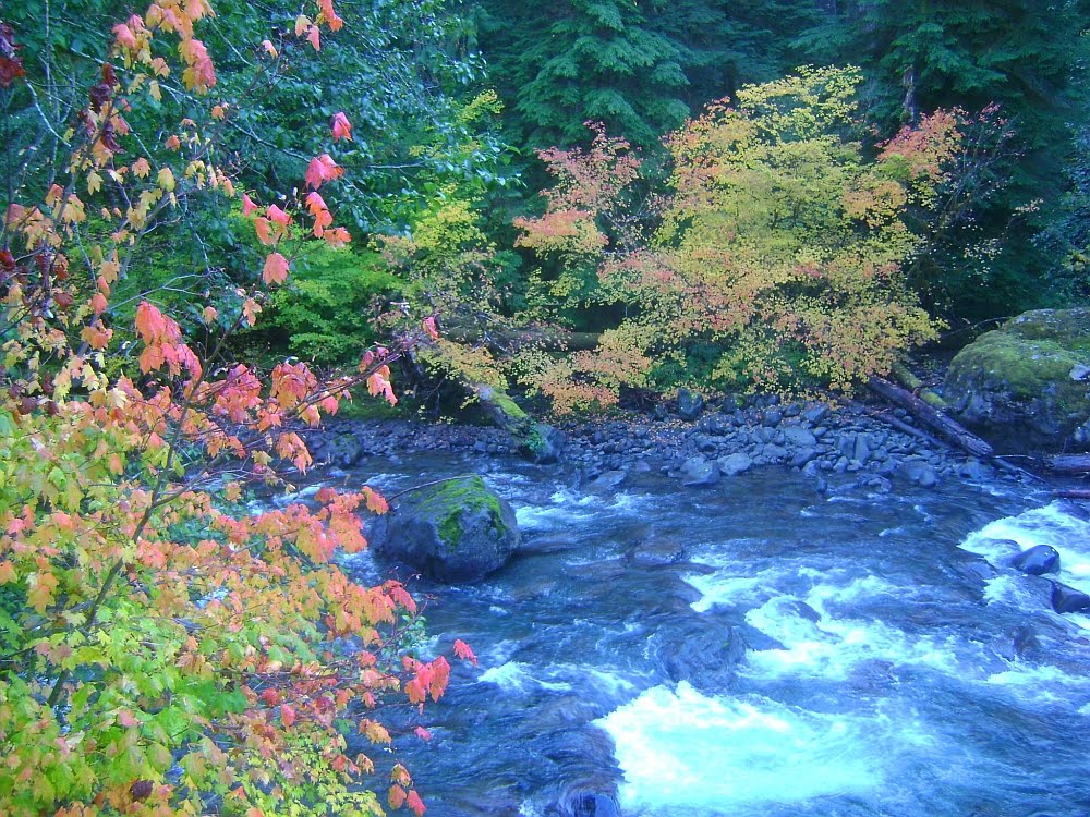
On Sunday along US 101 west of the lake, the vine maples were at the height of their color. The sun came and went. In the sunshine, in some places, they absolutely flamed.

October 23, 2011. Maybe near E. Snider Road. (Click for larger image.)
... (Click for larger image.)

The sun came and went. A rainshower passed by.

Rialto Beach, James Island, October 23, 2011 (Click for larger image.)
Ocean in the Sun, October 23, 2011 (Click for larger image.)

I read for a while.

Soundscape for Cee, Retreating Tide

No pelicans. On the way home, out over the river, two bald eagles were hunting hunting, talons hanging down and head bent to eyeball the water. They'd stoop. Didn't seem to carry off anything. They were very vocal.

The Blue Garage

The blue garage in the alley has red leaves in its garden patch. In the spring, forsythia. In the summer, sunflowers.

October 24th, 2011, in the alley. (Click for larger image.)

Going To See the Elephant

The news is everywhere, science blogs and NYT and the sort of science journalists who find something hot to write about in each week's Science Magazine. And the local papers, including the weekly Sequim Gazette, are going wild.

Did I know we had a mastodon? No. Did I know Sequim has a museum with a natural history exhibit? No. But boy I sure now know that we are in the forefront of paleontological news, with a confirmed pre-Clovis hunting site. Boy howdy.

Beastie was excavated in the 70s, from the Manis farm in the Happy Valley area of Sequim. But the paleontological establishment told the researcher who did the work that it couldn't have been as early as he said. And science filed his findings in limbo, though the Manis Mastodon remained in the museum and on the mental maps of local people who have been around a long time.

The news is that it has been retested and firmly dated to 13,800 years ago; and the truly lovely part of the story is that the guy with way-modern dating technology worked with the original researcher, Dr. Carl Gustafson, lo these 35 years later, and he appears as one of the authors of the new paper. Take that, Clovis-first true believers.

The root story, in Science: (1). Lots of other stories: (2)(3)(4). The critter is not nearly as large as I imagined. Lovely size chart at New York State Museum's web site.

Keeping the museum's hours in mind, to plan a visit to the elephant ancestor's bones.

Friday, October 21, 2011

Fifteen Feet Down, 195 Feet to Go

Barnard Construction is going to take the Glines Canyon Dam down another four feet before the end of the month, then shift activities out of the river flow for the first 'fish window' (to protect the salmon in the lower five miles of the river). An article in the Peninsula Daily News pointed out yesterday that this means some 15 feet of the 210-foot Glines Canyon Dam will have been removed as of November 1.

9:55 AM, October 21, on the DamCam (Click for larger image.)

PDN is doing a great job of keeping us up-to-date. I wish they would ask Barnard Construction how many feet down they can go with the present notching procedure, i.e. when the working barge will ground on the rubble-filled silt upstream of the dam face. It's all just getting dropped in, for now...

Tuesday, October 18, 2011

Up on the Sol Duc

Went looking for leaping salmon, on the theory that the ocean will still be there after my trip to Santa Fe and Crestone, but the returning coho salmon run will have ended before I have another chance to look. River flow at the Cascade pretty low, and I only saw one jumper. I think that they were there, but can just swim invisibly up the flow at this volume.

Sol Duc River at Salmon Cascades, River Mile 59, October 16, 2011. (Click for larger image.)
The Forest at the Cascade (Click for larger image.)
... (Click for larger image.)

The light is golden all day long in the winter forest.

(Click for larger image.)