August 3-6, 2011, with VMW in Nevada City in the northern Sierra Nevada foothills. I've known her 40+ years, and we talked and talked, about then, about now, about the in-between. Our memories run parallel, not the same. Our pasts are rooted in different realities, even for the parts that took place at the same time in the same place. "Why don't I remember that?" "Because I left the commune two years after you did." (Because we were mostly out of touch for about 20 years.)
Surprisingly low elevation, the town is at 2525'. The plan was, roughly, to show me places she has lived in, loved, took her son hiking and camping in, for the past 26 years; we kept veering aside to see this or that on our way to here or there, and looping around the back ways. As a result I was, roughly, disoriented much of the time despite having good maps in my lap... It is Yuba River country; the highways that define how you get anywhere are CA49 and CA20; the backcountry there is the lower-elevation northern end of the Sierra Nevada, peaks not more than 8000' to 9000'.
So I pulled into V's driveway about 3PM, handed her her hostess gift of Triple Ginger Snaps, and pretty soon we were on our way to short walk #1, 'to the river' she called it, though we were from my point of view up on the hillside following ditches and flumes (lotsa ditches and flumes and reservoirs and remains of mine workings in any local story there: this is the Gold Country) horizontally along the Independence Trail. Got as far as a viewing deck by a little pool and falls at what I think was Rush Creek. Introduced her new dog Tess to the pool; dog was a bit skeptical about water. Back to the car and continued on the the old bridge over the South Fork of the Yuba, just to get a look at it. This spot figures in everyone else's memory of the commune's first expedition to look for land, in 1969. I was along on that trip, but don't remember...

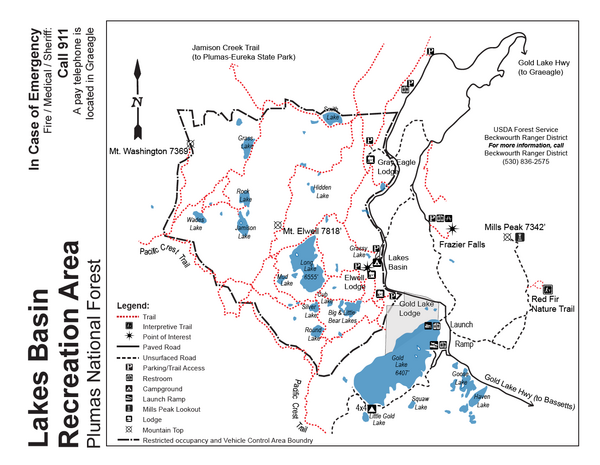
Thursday, up CA49 along the north fork of the Yuba River, through the picturesque gold-country town of Downieville (3888'), and sharp left at a place called Bassetts, and north past Sierra Buttes into the Lakes Basin Recreation Area. Short walk past Grassy Lake and on a ways. Retrace, and short walk to Frazier Falls (6200').


Unlike the higher country to the south with its granite batholith exposures, this is pretty well where the northern Sierra overlay by volcanics begins. There was sure-enough glacially smoothed bare naked rock on the trail to Frazier Falls, but it was the andesite of Sierra Buttes. Nevertheless extremely satisfying to sit on with legs stretched out flat and hands pressing down towards the heart of the earth. We were doing wildflowers all day, of which there were still plenty though it was August, but neglected to maintain a list of what we saw.


Friday August 5 was a 3-event day, and will get its own post.


2 comments:
Love seeing your photos. Makes me think of John Muir's words:
"Oh, these vast, calm measureless mountain days, inciting at once to work and rest! Days in whose light every thing seems equally divine, opening a thousand windows to show us God."
Except, of course, I don't believe in God, but other than that those windows do open.
One of these days gotta do my own long-deferred NCal roots revisit road trip except that MS & I always turn out to have rather conflicting visions of what the trip should include. Notwithstanding that, I did manage to hitchhike much of the length of highway 49 in March 1977, largely because I got picked up by a young (as was I then) woman from around Placerville who became inspired to take her two young sons and two (or was it four?) large dogs to visit her family in Phoenix, driving us down 49 and eventually to Cajon Pass where I got off and slept between the train tracks.
Post a Comment